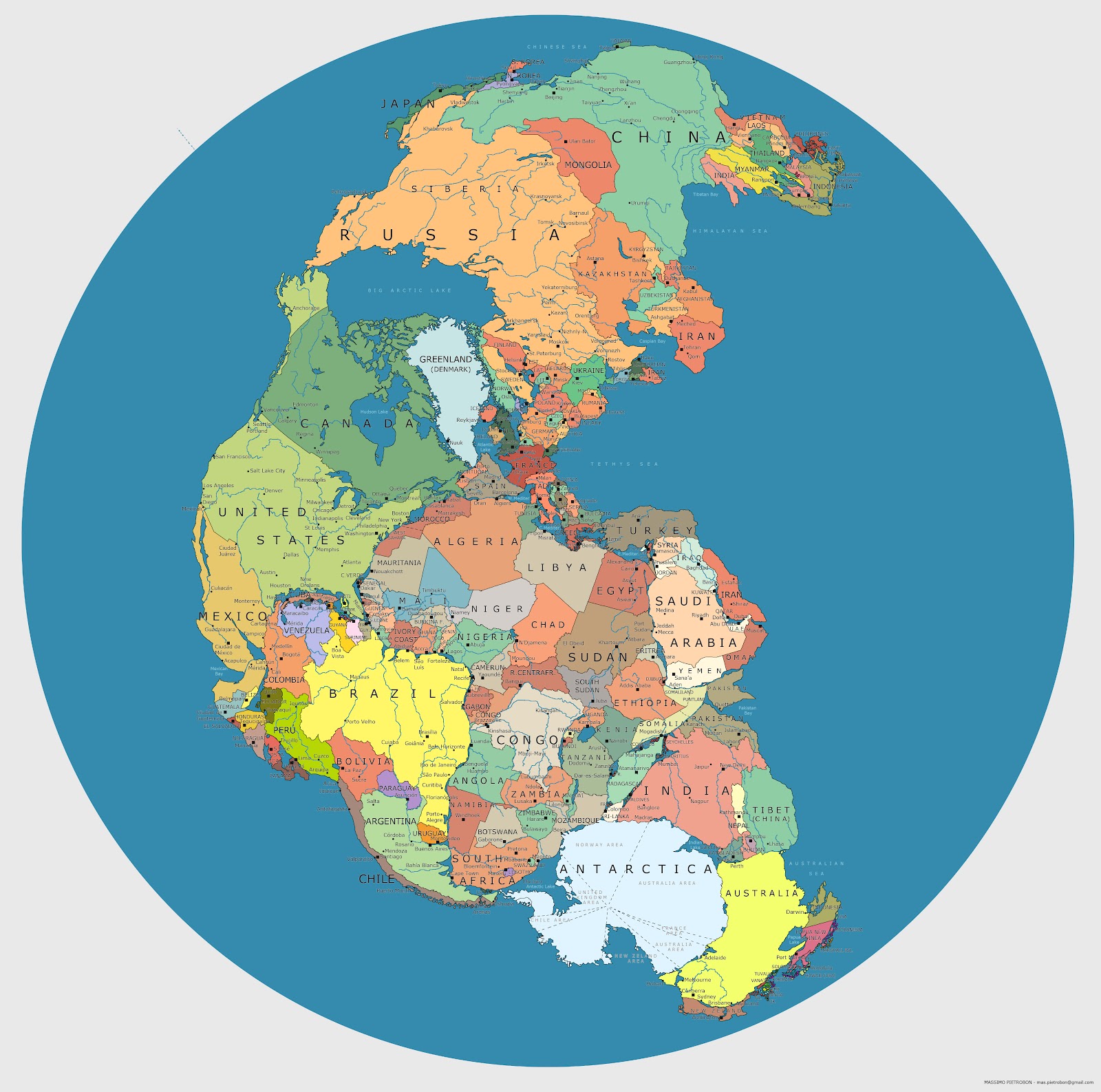
The supercontinent of Pangea formed some 270 million years ago, during the Early Permian Period, and then began to break up 70 million years later, eventually yielding the continents we inhabit today. Pangea was, of course, a peopleless place. But if you were to drop today’s nations on that great land mass, here’s what it might look like. (Click on the image to view it in a much larger, high resolution format.) The map’s creator is Massimo Pietrobon, someone who playfully describes himself as “a famous explorer and cartographer of Atlantis,” and who has taken on other experiments with maps in the past. When someone claimed that the scale of certain countries wasn’t exactly right, Massimo was quick to confess on his blog, “Yes, it’s just a trial, it can be better.” But it’s a creative start.
via Pickover’s Reality Carnival
Related Content:
An Interactive Map of Odysseus’ 10-Year Journey in Homer’s Odyssey
Play Caesar: Travel Ancient Rome with Stanford’s Interactive Map
Download 78 Free Online History Courses: From Ancient Greece to The Modern World
Map Showing Where Today’s Countries Would Be Located on Pangea is a post from: Open Culture. Follow us on Facebook, Twitter, and Google Plus, or get our Daily Email. And don’t miss our big collections of Free Online Courses, Free Online Movies, Free eBooks, Free Audio Books, Free Foreign Language Lessons, and MOOCs.
The post Map Showing Where Today’s Countries Would Be Located on Pangea appeared first on Open Culture.
Map Showing Where Today’s Countries Would Be Located on Pangea
No comments:
Post a Comment